What is GIS and when is it used?
Geographic information systems (GIS) are used across many industry sectors, including planning, property, and the environment. GIS are computerised systems used for the collection, storage, analysis, manipulation and presentation of complex geographical information. Roles vary, although most GIS officers are involved in the production of maps and the analysis of data.
GIS technology allows many different forms of data - such as the location of rivers and roads, or information about soil, vegetation or people - to be overlaid on top of each other on one map. The data can be manipulated so that all the sources have the same scales, allowing complex readings to be taken from the map. This enables people to analyse patterns and better understand relationships between different aspects, and the implications of proposed developments and changes.
The Target Jobs website identifies that many GIS Managers work for specialist software development companies and consultancies, utilities companies, telecommunications companies, insurance companies, local/police authorities, emergency services, government departments (such as HM Land Registry) and motor vehicle rescue services.
What do I need to have?
The level of qualification you need will depend to a large extent on the role for which you are applying, the systems you will be using and the employer. For example, an undergraduate degree in a related subject may be useful, although many GIS Officers identify that the most common route into the profession is with a degree or postgraduate qualification in GIS, geography or computer sciences.
If you are seeking a role in which using GIS forms part of a wider range of responsibilities and duties, your undergraduate qualification may be sufficient, as long as you possess sufficient experience with the key elements of the systems and are able to articulate this. Roles within some smaller organisations may often require someone with a broader knowledge and range of skills, whereas larger organisations sometimes have more specialised roles.
Many geography, earth and environmental science undergraduate degrees now include GIS modules, and many computer science degrees provide a range of programming and applications skills. GIS postgraduate degrees offer a mix of skills and knowledge, with many courses having links directly to industry. However, depending on the position, an understanding or expertise in other areas, such as retail or economics, could prove beneficial. Specific entry requirements vary between employers.
A range of postgraduate GIS courses are available, and some employers may favour candidates who offer postgraduate qualifications, whilst some may support and encourage candidates to obtain postgraduate qualifications alongside working.
More about careers in GIS and what is required
Comprehensive overviews of GIS Officer roles and GIS Systems Manager roles are available on the Prospects and Target Jobs websites. In addition, the GIS Lounge website has a helpful insight into building a GIS career.
The following websites often list GIS opportunities, or provide sector-specific information:
In addition, opportunities are often advertised on recruitment websites, such as Monster, Reed, and Jobsite.
What are my chances?
The Prospects website reflects that, as GIS occupations become more established and competitive, it's likely to become more difficult for people with less relevant qualifications to gain entry, therefore you'll need to show:
- Strong written and oral communication skills, as well as presentation skills
- Motivation and a pro-active attitude
- The ability to translate requirements into working solutions
- Computer skills including the use of complex databases and spreadsheets, and specific software such as ArcGIS
- That you are highly numerate and able to analyse data and statistics
- The ability to work well under pressure
What can I do to improve my prospects?
Experience gained outside of your degree is always helpful to demonstrate that you are proactive and committed to a particular career. Work experience and sandwich-year placements may provide an advantage in job applications and are especially useful to graduates aiming to progress into GIS management in the future. Volunteering, work experience opportunities and internships can be found with local councils, governmental bodies such as the Environment Agency and nature organisations.
Some organisations you may wish to consider include Esri and the Ordnance Survey as well as users of GIS data sets, such as the RSPB, The Forestry Commission, the British Geological Society (BGS) and the Game & Wildlife Conservation Trust (GWCT). Further research will highlight a multitude of other organisations which use GIS datasets with increasing amounts available in the public domain from sources such as the Environment Agency.
Many other organisations provide GIS functions to their clients, for example working as contractors or developers, acquiring or providing remotely sensed data or planning functions. With a little research, you should be able to find directories of these organisations fairly easily on the Internet. The British Association of Remote Sensing Companies (BARSC) has a directory of its members, with links to their websites, which you can use to search for advertised opportunities, or to undertake research and make speculative applications. The European Association of Remote Sensing Companies (EARSC) provides similar information for the continent, as well.
Another useful online tool to find organisations using GIS is the ENDS Directory – this classes itself as, “a complete guide to environmental consultants and service providers” and it is possible to search with keywords such as “GIS” to identify appropriate organisations.
Daily emails from sources such as the Countryside Jobs Service can keep you informed of a wide range of opportunities, including those utilising GIS.
Positions can be highly competitive as GIS becomes a more popular subject to study. Therefore, it can be beneficial to tailor each application, to demonstrate your passion, knowledge of the employer and skills you can bring.
Sector-specific organisations and societies exist which you may wish to consider joining, for example The Association for Geographic Information (AGI). The GIS Lounge website provides a comprehensive list of international organisations that may be of benefit. When considering joining any society or similar body, it is often helpful to consider what you hope to gain from membership, how you think your membership will be viewed by prospective employers and how you might articulate the benefits to them, as well as what you might contribute through your membership. You might find it helpful to speak to industry experts such as alumni from the university who now work in the sector, to ask which organisations they, or their employers, are affiliated to and what they perceive the benefits to be. You can often find alumni through LinkedIn.
There are a number of other industry-specific societies and organisations related to GIS, which you may wish to review if you are considering membership of a professional body, including:
Aside from gaining experience, you may also wish to ensure that you are competent using applications and systems that are regarded as standard in the industry – for example, ArcGIS. If you have an opportunity to gain a qualification from a recognised assessor to evidence your proficiency, that might be helpful. Another approach might be to ensure that you have completed projects using the system, so that you are able to demonstrate to others the means by which you used the system to achieve your goals.
Employers can also favour prospective employees who are able to demonstrate coding skills, which will enable them to help refine or tailor systems for specific uses. If you have coding experience or are able to gain any, this can be helpful.
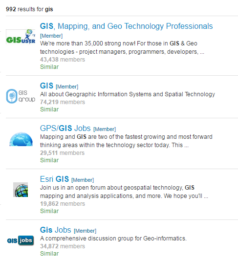
You may also find it helpful to use social media such as LinkedIn to join GIS discussion groups, as well as GIS job boards, to take part in discussions relating to GIS and to keep yourself up-to-date on developments in the industry. For example:
Finally, with so many different organisations using GIS, you may also find it helpful to be aware of the employers who are on campus throughout the year, and to speak with them directly about their opportunities. To do this, please remember to check the events page on Careers Network’s Intranet pages regularly.